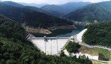
Managawa Dam | Dams in Fukui viewed from drone
2020.06.17
Name : Managawa Dam
Location : Shimo-wakago, Ono City, Fukui Prefecture
The name of the river : Mana-gawa River - Kuzuryu River System
Type : Unequal thick concrete arch dam
Gate : Crest gate x 4
Conduit gate x 2
Small discharge valve x 1
Administrator : Ministry of Land, Infrastructure, Transport and Tourism
Year of completion : 1977
Shooting day : Jun 14th , 2018
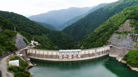
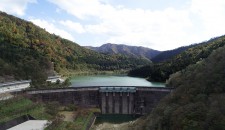
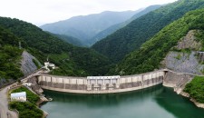
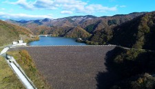
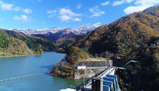
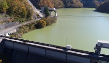
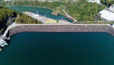
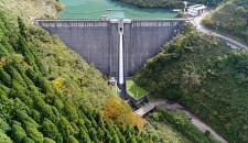
A full view of the Managawa Dam. The dam lake is Lake Manahime, which was named after a local legend.
On National Route 157 heading for Gifu from Ono City, the dam with a beautiful arch-like curve appears at the side of the road. When Fukui was hit by heavy rain and severely damaged along the Asuwa River in July 2004, the Managawa Dam and its upstream Sasogawa Dam were very effective for flood control and no flood damage caused in the Mana-gawa river area. So it cleared the way for resuming of construction of Asuwa-gawa Dam, which had been frozen.
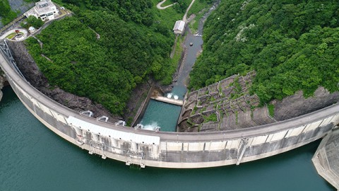
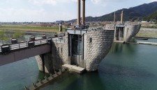
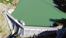
An energy dissipator located directly below the dam and a fountain (a round spot around near the center of the upper part of the photo)
The day I visited the dam, it was discharging water from the small discharge valve on the dam body, so the fountain wasn’t working.
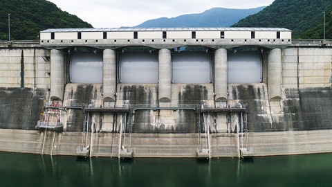
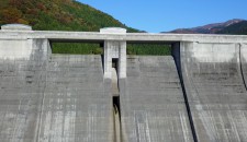
The emergency spillways at the center of the crest gate are a quadruple radial gate.
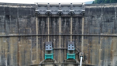
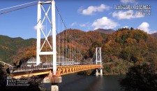
All the gates get together at the center of the dam body viewed from the downstream side
Dam Card
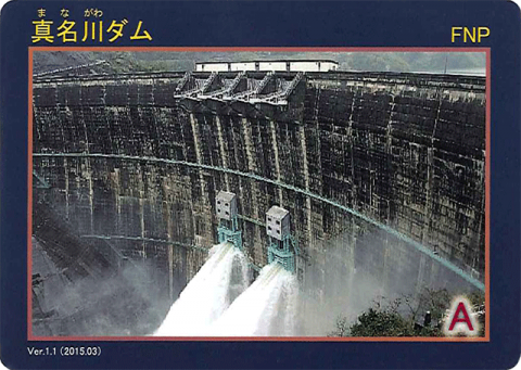
Dam Card (front) Ver.1.1 (2015.03)
They distribute the Dam Card at the Managawa Dam Control Branch Office on the left bank.
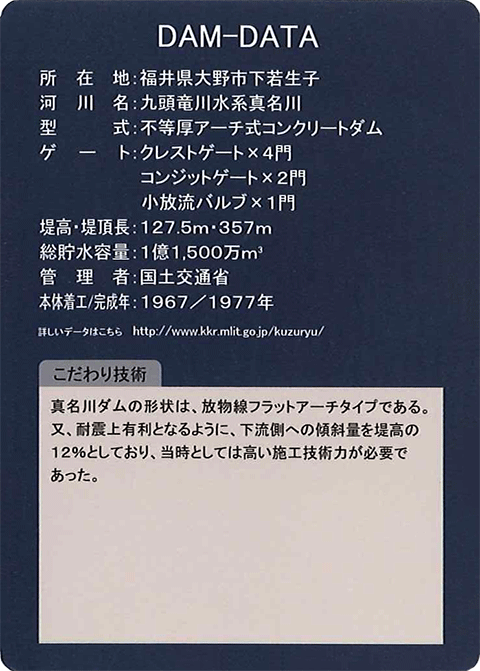
Dam Card (back)
“Dams in Fukui viewed from drone” is a project that introduces dams in Fukui Prefecture through videos with concept of “Moving dam cards”.