Naruka Weir | Dams in Fukui viewed from drone
2020.06.15
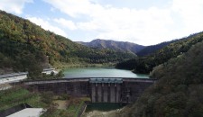
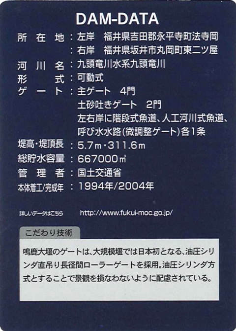
Name: Naruka Weir
Location: The left bank: Hojioka, Eiheiji Town, Yoshida County, Fukui Prefecture
The right bank: Higashi-futatsuya, Maruoka Town, Sakai City, Fukui Prefecture
The name of river: Kuzuryu River-Kuzuryu River System
Type: Movable
Gate: Four main gates
Two earth discharge gates
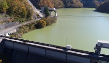
Stepped fishways, artificial fishways and each one pump-priming stream (gate for slight adjustment) are provided along both banks of the river.
Administrator: Ministry of Land, Infrastructure, Transport and Tourism
Year of completion: 2004
Shooting day: April 4th and May 9th, 2019
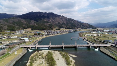
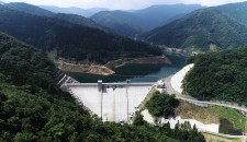
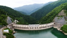
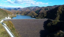
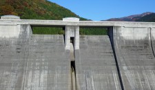
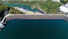
Full view of the Naruka Weir.
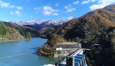
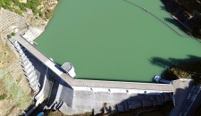
There is a bridge for observing slightly above from here.
The movable Naruka Weir is located at the place where Kuzuryu River, which is the representative river of Fukui Prefecture, flows into the Fukui Plain. The appearance of the pillars is simple, which was adopted the nation's first new technology, the roller gate with hydraulic cylinder direct suspension system. It is designed based on boat and deer, which creates the distinctive scenery that harmonizes with the surroundings. Also, the weir is environmentally friendly and several fishways that have a structure according to fish are provided.
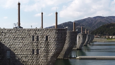
The view as if boats' bows are lined is spectacular.
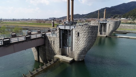
The hydraulic mechanism is worth seeing.
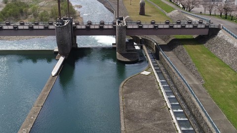
The fishway was created with consideration for biology of fish.
Dam Card
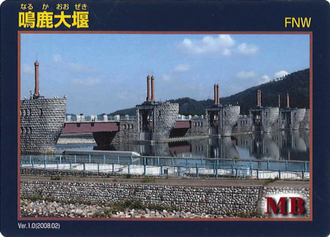
Dam Card (front) Ver.1.0 (2008.02)
Dam Card (back)
They distribute the Dam Card at Naruka Weir's control office on the left bank.
"Dams in Fukui viewed from drone” is a project that introduces dams in Fukui Prefecture through videos with concept of “Moving dam cards”.